

Bushfire Ready Map app for iPhone and iPad
Developer: CreativityCorp Pty Ltd
First release : 25 Oct 2012
App size: 4.68 Mb
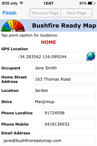
Bushfire Ready Map for iPhone and iPad enables a standardised assessment of bushfire hazard and risk management for homes. The information can be displayed by tap on a home in Google Earth (also available in App Store). Bushfire Ready Map assessments are intended to be conducted by Bushfire Brigade Officers and the information is to be held confidentially by the relevant Brigade to assist service provision during a bushfire.
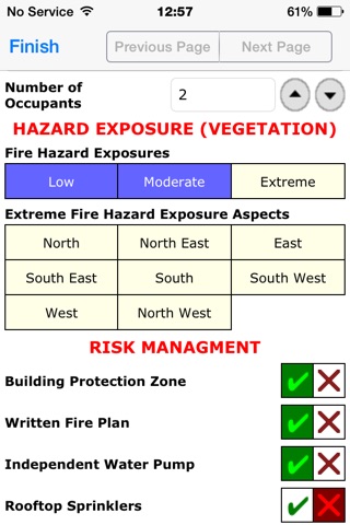
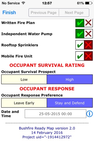
Bushfire Ready Map provides guidance for the assessment process by tap to the assessment point caption. Bushfire Ready Map has been developed using criteria for determining bushfire Hazard Exposure and Building Protection Zone which apply in Western Australia. Similar criteria are used elsewhere in Australia. The assessment can be amended for wildfire conditions in the United States and other countries. The hazard and risk approach is universal.
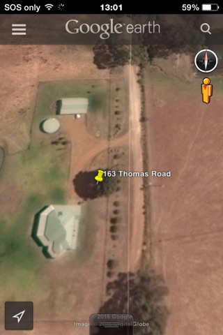
After conducting assessments of homes using Bushfire Ready Map, connection is made via the mobile phone network or WiFi to Mobile Data Studio software for processing of data to a KML file which can be opened in Google Earth. After collection of Bushfire Ready Map data with the App, a 30 day period is provided in Mobile Data Studio without cost to users to process Bushfire Ready Map App data to KML files for display in Google Earth.
A tap to the GPS marker on homes in Google Earth displays the vital information. The KML file can be opened in Google Earth on a smartphone, tablet, notebook and desktop computer. The data can also be automatically processed to Excel in Mobile Data Studio and downloaded for use by the relevant Brigade.
The vital information graphically displayed using the Bushfire Ready Map system will assist Brigades to contact occupants of homes during bushfire alert and in deployment of resources for fire fighting and evacuation.
The assessment conducted using Bushfire Ready Map during visits by Brigade Officers to homes is also an effective awareness raising process for home occupants and the community.